
Walking routes around Beddgelert in Eryri (Snowdonia) — from gentle riverside strolls to big mountain days. Many start directly from the village, with classic routes to Yr Wyddfa (Snowdon) and across the wider North Wales landscape.
Staying nearby? Perthi Holiday Cottages sits just above Beddgelert — several of these walks begin right from the door.
Good to know
Each walk includes distance, difficulty, estimated time and a downloadable map. All routes are described from the perspective of staying in Beddgelert. Distances and times are approximate, and conditions in Snowdonia can change quickly, so walkers should always assess their own ability, the weather and ground conditions before setting out.
Find a walk by category
Start with Most Popular if you’re unsure where to begin.
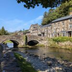
Gelert’s Grave Riverside Walk, Beddgelert
Length: 1.85 km (1.15 miles)
Difficulty: Easy
Approx. duration: 1hr
The legend says a prince killed his faithful dog by mistake and never smiled again. An easy riverside walk from Beddgelert village to find out why.
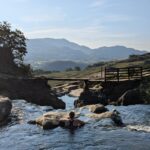
Watkin Pools & Waterfall Walk, Nant Gwynant
Length: 3.62 km (2.25 miles)
Difficulty: Moderate
Approx. duration: 1-2hrs
Turquoise mountain pools and waterfalls on the lower slopes of Yr Wyddfa — a rewarding circular walk suitable for most abilities. Free parking nearby if you arrive early.
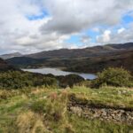
Dinas Emrys Merlin Hillfort Walk, Beddgelert
Length: 3.44 km (2.14 miles)
Difficulty: Easy
Approx. duration: 1:30hrs-2hrs
Welsh legend says Merlin buried dragons beneath this hill. A short woodland walk from Craflwyn with a waterfall en route and views from an ancient hillfort.
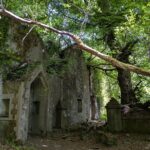
Dorothea Slate Quarry Walk, Nantlle
Length: 4.66 km (2.9 miles)
Difficulty: Easy
Approx. duration: 1-2hrs
Ruins, flooded lakes and dramatic slate scenery at a forgotten Victorian quarry near Beddgelert. A gentle circular walk through Welsh industrial history with a good coffee at the end.
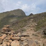
Watkin Path & South Ridge Loop, Yr Wyddfa
Length: 13.23 km (8.22 miles)
Difficulty: Hard
Approx. duration: 5-6 hours
A spectacular loop combining the dramatic Watkin Path waterfalls with a quiet South Ridge descent. Features historic ruins and easy scrambling with no backtracking.
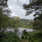
Beddgelert Forest Walk to Hidden Lake
Length: 7.63 km (4.74 miles)
Difficulty: Easy
Approx. duration: 2-2:30hrs
A quiet lake most visitors never find — easy circular forestry walk through Beddgelert Forest to Llyn Llywelyn, with Yr Wyddfa (Snowdon) views above the treeline.
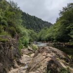
Aberglaslyn Gorge & Valley Walk, Beddgelert
Length: 8.13 km (5.05 miles)
Difficulty: Moderate
Approx. duration: 3-4hrs
Dramatic gorge, quiet valley and industrial history on one circular walk from Beddgelert.
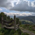
Craflwyn and Llyn Dinas Walk, Quiet Valley Route
Length: 10.83 km (6.73 miles)
Difficulty: Moderate
Approx. duration: 3-4hrs
One of the most varied walks near Beddgelert — quiet valleys, the Watkin Pools and Llyn Dinas all in one circular route. A hidden gem that most visitors miss.
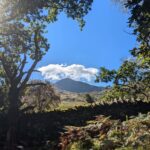
Moel Hebog Summit Walk, Beddgelert
Length: 8.74 km (5.43 miles)
Difficulty: Hard
Approx. duration: 3-5hrs
Circular mountain route up Moel Hebog, with wide views towards Yr Wyddfa and the Llŷn Peninsula, descending through Beddgelert Forest.
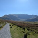
Snowdon Ranger Path to Yr Wyddfa Summit
Length: 12.95 km (8.05 miles)
Difficulty: Hard
Approx. duration: 5-6 hours
The quietest and most straightforward route up Yr Wyddfa (Snowdon) — no scrambling, steady gradients, and none of the crowds from Llanberis.
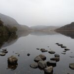
Llyn Dinas & Gwynant Valley Cafe Walk, Beddgelert
Length: 10.62 km (6.6 miles)
Difficulty: Moderate
Approx. duration: 2:30-3:30hrs
There-and-back riverside route beside the Gwynant River, passing Llyn Dinas to Caffi Gwynant, with flat paths and open valley scenery.
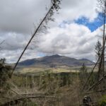
Forgotten Quarry Loop via Bwlch y Ddwy Elor
Length: 8.42 km (5.23 miles)
Difficulty: Moderate
Approx. duration: 3-4hrs
A lesser‑known loop leading to the “gap of the two biers” linked to old funeral traditions. Descend into the forgotten quarry ruins before returning through quiet forest trails.
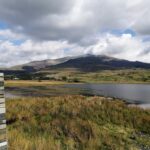
Llyn y Gadair Pub Walk, Beddgelert Forest to Rhyd Ddu
Length: 6.32 km (3.93 miles)
Difficulty: Moderate
Approx. duration: 2-2:30hrs
A circular walk we put together ourselves — forest, a lakeside causeway, close-up Yr Wyddfa views and a traditional pub at Rhyd Ddu. A lesser-known route that packs a punch.
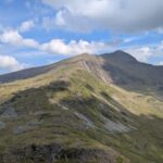
Snowdon South Ridge Summit Walk, Rhyd Ddu
Length: 12.60 km (7.83 miles)
Difficulty: Hard
Approx. duration: 5-6 hours
A quieter way up Yr Wyddfa (Snowdon) most walkers drive straight past — circular via the wild South Ridge with easy scrambling and none of the Llanberis crowds. A hidden gem.
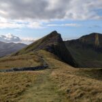
Y Garn & Drws y Coed Ridge Walk
Length: 8.16 km (5.07 miles)
Difficulty: Hard
Approx. duration: 3-5hrs
One of the best easy scrambles in Snowdonia — steep, exposed in places, and stunning. A alternative to the Nantlle Ridge without needing two cars.
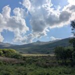
Yr Aran Summit Walk from Beddgelert Forest
Length: 10.94 km (6.8 miles)
Difficulty: Hard
Approx. duration: 3-5hrs
Snowdon's quieter neighbour — Yr Aran sees a fraction of the footfall but the summit views of Yr Wyddfa are outstanding. A hidden mountain walk from Beddgelert Forest.
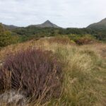
Llanfrothen to Croesor Cafe Circular Walk
Length: 5.71 km (3.55 miles)
Difficulty: Moderate
Approx. duration: 2-3hrs
A peaceful circular walk from near Llanfrothen to Croesor, featuring superb views of Cnicht, quiet countryside and a relaxing café stop.
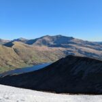
Mynydd Mawr Summit Walk, Rhyd Ddu
Length: 8.72 km (5.42 miles)
Difficulty: Hard
Approx. duration: 3-4hrs
Exceptional views of Snowdon and the Menai Strait from a summit almost nobody else visits. A quiet, rewarding there-and-back from Rhyd Ddu near Beddgelert.
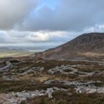
Tre’r Ceiri Ancient Hillfort Walk, Llithfaen
Length: 6.59 km (4.1 miles)
Difficulty: Hard
Approx. duration: 2:30-3:30hrs
One of the best-preserved Iron Age hillforts in Britain, with coastal views on three sides. Our favourite walk outside Eryri National Park — varied, uncrowded and genuinely special.
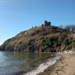
Criccieth Coastal Walk to Llanystumdwy
Length: 7.25 km (4.51 miles)
Difficulty: Easy
Approx. duration: 2-3hrs
An easy coastal and countryside loop from Criccieth to Llanystumdwy, with wide sea views, peaceful farmland, and a rewarding food stop back in town.
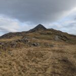
Cnicht “The Welsh Matterhorn” Summit Walk
Length: 6.37 km (3.96 miles)
Difficulty: Hard
Approx. duration: 2:30-3:30
One of Wales's most iconic mountain profiles — and one of the quickest summits in Eryri. Cnicht looks impossible from below but it's done and dusted in a half day.
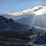
Dinorwic Quarry & Castle Loop, Llanberis
Length: 8.2 km (5.1 miles)
Difficulty: Moderate
Approx. duration: 2-3 hrs
Dinorwic Quarry and Dolbadarn Castle in one circular walk — a less-used route that avoids the crowds, with medieval castle views at the end as your reward.
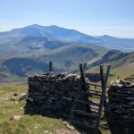
Moel Eilio Horseshoe, Waunfawr
Length: 11.92 km (7.41 miles)
Difficulty: Hard
Approx. duration: 3-4hrs
The walk locals do — a mountain horseshoe above Waunfawr with Snowdon filling the skyline all day. Clear paths, no scrambling, and worth doing the full circuit not just the first summit."
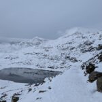
Miner’s Path to Llyn Llydaw, Snowdon Views
Length: 7.49 km (4.66 miles)
Difficulty: Easy
Approx. duration: 2-2:30hrs
Get close to Yr Wyddfa (Snowdon) without climbing it — the Miner's Path to Llyn Llydaw puts you right inside the Horseshoe on a clear, well-marked path.
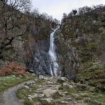
Aber Falls Waterfall Walk, Abergwyngregyn
Length: 6.79 km (4.22 miles)
Difficulty: Moderate
Approx. duration: 2-3hrs
One of North Wales's most dramatic waterfalls at the end of a circular walk with sea views towards Anglesey. Go early or midweek — it gets busy.
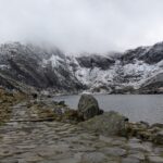
Cwm Idwal Glacial Valley Walk, Ogwen
Length: 4.15 km (2.58 miles)
Difficulty: Easy
Approx. duration: 1:30hrs-2hrs
One of Snowdonia's most dramatic short walks — ice-sculpted cliffs, a black mountain lake and big scenery on clear paths. Go early or out of season to avoid the crowds.
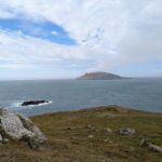
Aberdaron Coastal Path Walk, Llŷn Peninsula
Length: 9.60 km (5.97 miles)
Difficulty: Moderate
Approx. duration: 2:30-3:30hrs
Dramatic clifftops above the Irish Sea with Bardsey Island on the horizon — starting from a genuinely unhurried Welsh fishing village at the tip of the Llŷn Peninsula.
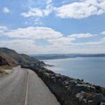
Great Orme Coastal Headland Walk, Llandudno
Length: 8.96 km (5.57 miles)
Difficulty: Moderate
Approx. duration: 2:30-3:30hrs
The Great Orme has its own microclimate — often clear when the mountains are in cloud. Coastal wildlife, Bronze Age history and a café halfway round. Good in any season.
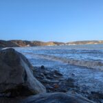
Porthdinllaen Coastal Pub Walk, Llŷn Peninsula
Length: 4.46 km (2.77 miles)
Difficulty: Easy
Approx. duration: 1-2hrs
Coastal paths to a fishing village with no road access and one of the world's great beachside pubs. A circular route that earns the pint at the Ty Coch Inn.
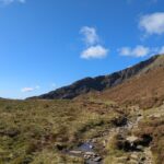
Moel Siabod via Daear Ddu Ridge Scramble
Length: 10.81 km (6.72 miles)
Difficulty: Hard
Approx. duration: 3-5hrs
The Daear Ddu Ridge scramble is one of Eryri's best. A classic Moel Siabod circuit most people drive straight past.
Walking FAQs
Are the walks suitable for beginners or families?
Some routes are gentle riverside or woodland walks, while others are mountain routes requiring good fitness and navigation skills. Each walk description notes the difficulty and suitability.
Do I need walking boots?
For valley and woodland walks, sturdy trainers may be fine in dry weather. For mountain routes, proper walking boots are strongly recommended.
Can I walk directly from the cottages?
Yes — you can walk straight from the cottages. A public footpath passes Perthi, and there are also a few private paths across our land that guests are welcome to use. From the cottages you can easily reach all the walks that start from Beddgelert village, walks that start further afield will require a short drive.
What about weather and safety?
Weather can change quickly in the mountains. Always check the forecast, carry suitable clothing, and turn back if conditions deteriorate.
Are dogs allowed on the walks?
Many local paths are dog-friendly, but some routes cross farmland or sensitive areas where dogs should be kept on leads. Always follow local signage.
Is phone signal reliable on the routes?
Mobile signal can be limited in valleys and remote areas, so don’t rely solely on your phone for navigation on mountain routes.
Are the routes suitable year-round?
Some walks are best in good weather and longer daylight hours. In winter, higher routes may require additional experience and equipment.